We all carry around a mental map of the world. We know roughly where things are, which countries are big, and which cities are north or south of each other. But sometimes that mental map needs a little recalibrating.
We do love our trivia here at Travel While Nerdy, but we all love when we get it wrong. So this time we're looking at places that aren't quite where you think they are, countries with unexpected borders, and geographical facts that might make you want to rotate a globe for a second look.
Ready to see how reliable your internal atlas really is?
1. Where would you find the world's largest desert?
A. North Africa
B. Antarctica
C. Central Asia
Reveal Answer
B. Antarctica.
Deserts are defined by how little precipitation they receive, not by how hot they get. Antarctica is the world's largest desert, while the Sahara is the world's largest hot desert. So yes, a continent covered in ice counts as a desert.
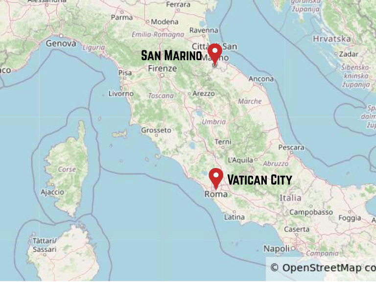
2. Which two independent countries are completely surrounded by Italy?
A. Monaco and Andorra
B. San Marino and Vatican City
C. Malta and Cyprus
Reveal Answer
B. San Marino and Vatican City.
Both are independent countries entirely surrounded by Italy. They're known as enclaves, and they're two of the world's smallest countries.
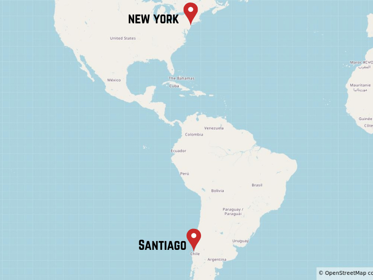
3. Which city is further west?
A. New York City
B. Santiago, Chile
C. They're roughly on the same longitude
Reveal Answer
A. New York City.
New York City sits at around 74° west longitude, while Santiago is around 71° west. That puts New York further west, despite Santiago being on the Pacific side of South America.
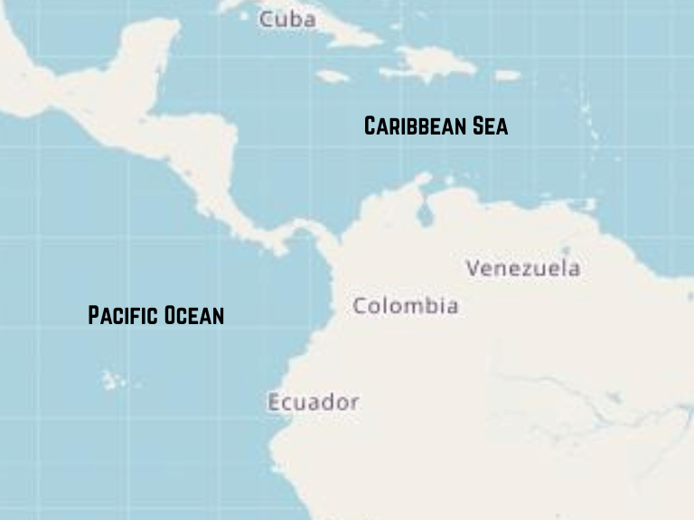
4. Which of these countries borders both the Caribbean Sea and the Pacific Ocean?
A. Colombia
B. Chile
C. Uruguay
Reveal Answer
A. Colombia.
Colombia, sitting in the northern part of South America, has coastlines on both the Caribbean Sea and the Pacific Ocean. Chile has a famously long Pacific coastline, while Uruguay sits on the Atlantic coast.
5. Which country shares France's longest land border?
A. Spain
B. Germany
C. Brazil
Reveal Answer
C. Brazil.
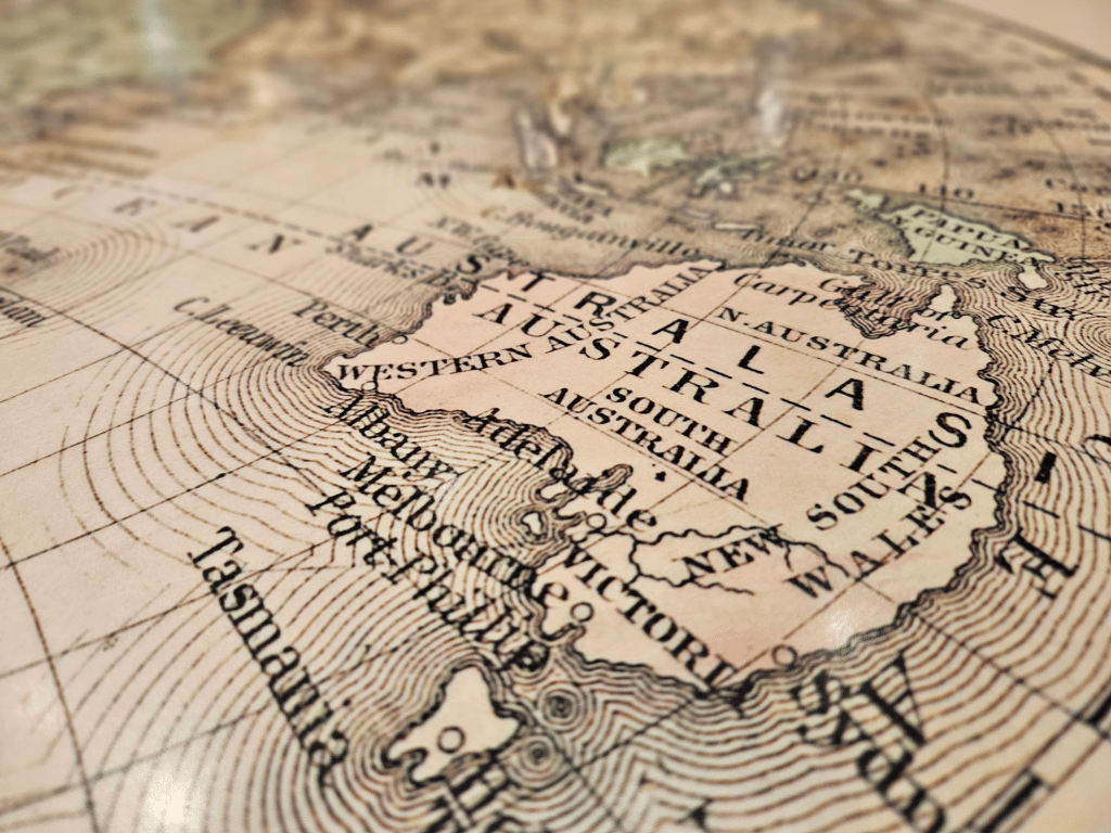
France's longest land border is with Brazil, thanks to French Guiana, an overseas department and region of France on the northeastern coast of South America.
6. Which country has more active volcanoes: Australia or New Zealand?
Reveal Answer
New Zealand.
New Zealand has far more volcanoes classed as active. But here's the interesting bit: active doesn't necessarily mean erupting right now. Scientists generally use the term for volcanoes that have erupted within roughly the last 10,000 to 12,000 years and could erupt again.
Australia has active volcanoes too, but they're on remote islands such as Heard Island and the McDonald Islands, thousands of kilometres from the mainland.
7. Which city is further north?
A. Rome
B. New York City
C. They're roughly on the same latitude
Reveal Answer
A. Rome.
Rome is at around 42° north latitude, while New York City is around 41° north. Rome is slightly further north, even though many people picture New York as the more northerly city. Latitude isn't always intuitive when you're comparing places on different continents.
8. Which famous city straddles Europe and Asia, with the Bosphorus separating its two sides?
A. Athens
B. Istanbul
C. Alexandria
Reveal Answer
B. Istanbul.
Istanbul spans two continents, with the Bosphorus separating its European and Asian sides. The strait connects the Black Sea with the Sea of Marmara. It's one of the world's great geographical crossroads, with the city itself sitting right across the divide.
9. In which country would you find Krakatau, the volcanic island dramatically reshaped by an eruption in 1883?
A. Japan
B. Indonesia
C. The Philippines
Reveal Answer
B. Indonesia.
Krakatau lies in the Sunda Strait between Java and Sumatra. Its catastrophic 1883 eruption destroyed much of the original island and had effects felt around the world. A new volcanic island, Anak Krakatau, later emerged in the same area.
10. Around what proportion of Africa's land area lies north of the Equator?
A. One-third
B. One-half
C. Two-thirds
Reveal Answer
C. Two-thirds.
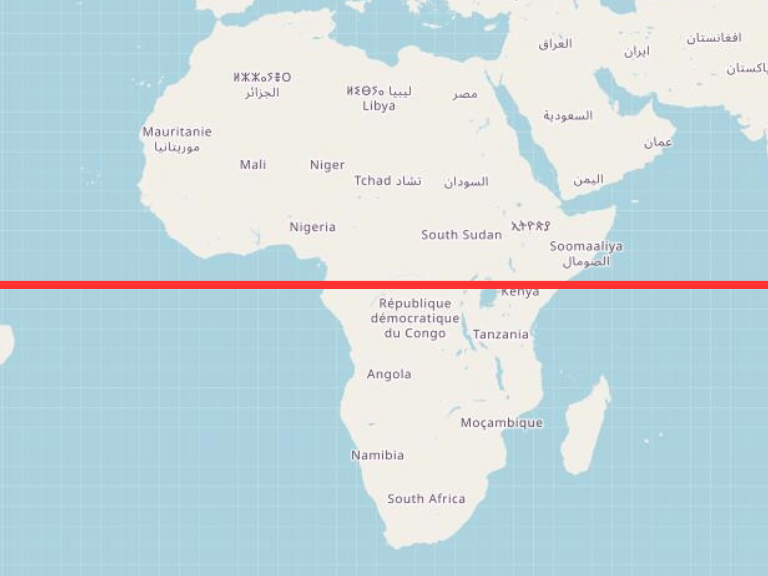
Africa is much wider north of the Equator than south of it, so roughly two-thirds of the continent lies in the Northern Hemisphere. It's an easy detail to overlook when we picture the Equator cutting neatly through the middle of the continent.
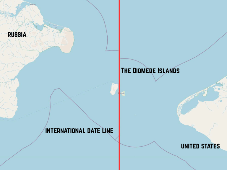
11. The Diomede Islands (Big Diomede and Little Diomede) are just 2.4 miles apart, yet have a 21-hour time difference. Why?
A. The International Date Line runs between them
B. They're on opposite sides of the Equator
C. They use different calendars
Reveal Answer
A. The International Date Line runs between them.
Big Diomede belongs to Russia, while Little Diomede belongs to the United States. The International Date Line passes between the islands, putting them on different calendar days. They're nicknamed “Tomorrow Island” and “Yesterday Island”, respectively.
How did you go?
Did your mental map hold up, or did a few of these send you back to the atlas?
Geography has a way of surprising us when we stop relying on the familiar shapes and start looking at the details. The world is full of borders, coastlines and distances that make much more sense once you see them properly.
Worth the trip: If this round has made you want to open a map and start poking around, that's a pretty good result. There's always something interesting hiding just beyond the edge of what we think we know.